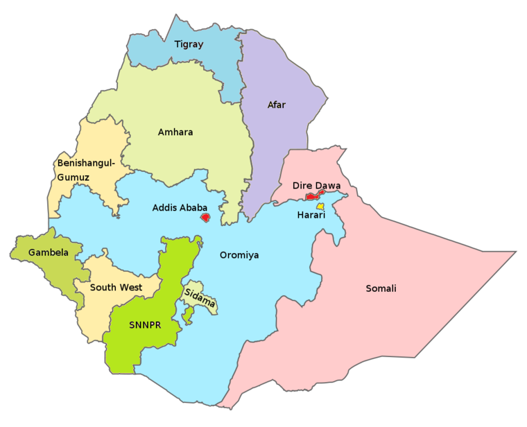
Harari
Consisting of the walled city of Harar and its immediate environs, Harari is essentially a modern revival of the autonomous city-state of Harar, which was one of the most powerful regional political entities from the 16th until the late 19th century, when it was co-opted into Abyssinia by Menelik II. The state covers an area of roughly 350 square km and supports a population estimated at 215,000, of which some 131,000 are city dwellers. Roughly half of the population is Oromo, with the Amhara accounting for another 33% and the Harari only 7%. Despite Harar's reputation as the home of Islamic Ethiopia, roughly 40% of its population is Christian. The lush farmland around Harar is known for its chat and coffee plantations, but other major crops include sorghum, maize and oranges
Harari Region Major Cities and Population
Regional States and Chartered Cities of Ethiopia
| 1 |
Addis Ababa |
Addis Ababa |
City |
527 |
3,434,000 |
| 2 |
Afar |
Asayita |
State |
72,053 |
1,812,002 |
| 3 |
Amhara |
Bahir Dar |
State |
154,709 |
21,134,988 |
| 4 |
Benishangul-Gumuz |
Asosa |
State |
50,699 |
1,066,001 |
| 5 |
Dire Dawa |
Dire Dawa |
City |
1,559 |
466,000 |
| 6 |
Gambela |
Gambela |
State |
29,783 |
435,999 |
| 7 |
Harari |
Harar |
State |
334 |
246,000 |
| 8 |
Oromia |
Addis Ababa |
State |
284,538 |
35,467,001 |
| 9 |
Somali |
Jijiga |
State |
279,252 |
5,748,998 |
| 10 |
Tigray |
Mekele |
State |
84,722 |
5,247,005 |
| 11 |
Southern Nations Nationalities and People (SNNPR) |
Awasa |
State |
54,400 |
9,126,000 |
| 12 |
Sidama |
Awasa |
State |
12,000 |
3,200,000 |
| 13 |
South West Ethiopia People Region (SWEPR) |
Bonga |
State |
39,400 |
2,300,000 |


